Friends of Padre

Friends of Padre Beach Report 2/17/2016

By Tyler Thorsen

Friends of Padre Beach Report 2/17/2016
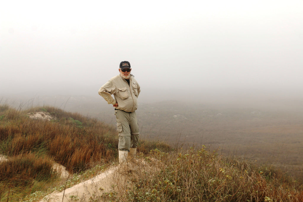
Via Captain Billy Sandifer and Troy Adler Troy Adler and I traveled the entire length of the beachfront. Fog was dense and remained off and on during the day and hindered seabirds attempting to feed and no bait fish were observed. Billytruck Billy The first 50 yards of the beach was soft although in the afternoon PINS personnel had graded it and it was much better. On low tide there were few soft spots; most of these are when large trees are blocking the beach and you have to drive up high around them. On high tide there was quite a bit of 4 wheel high driving; especially in the Big Shell. Billydevilselbow 
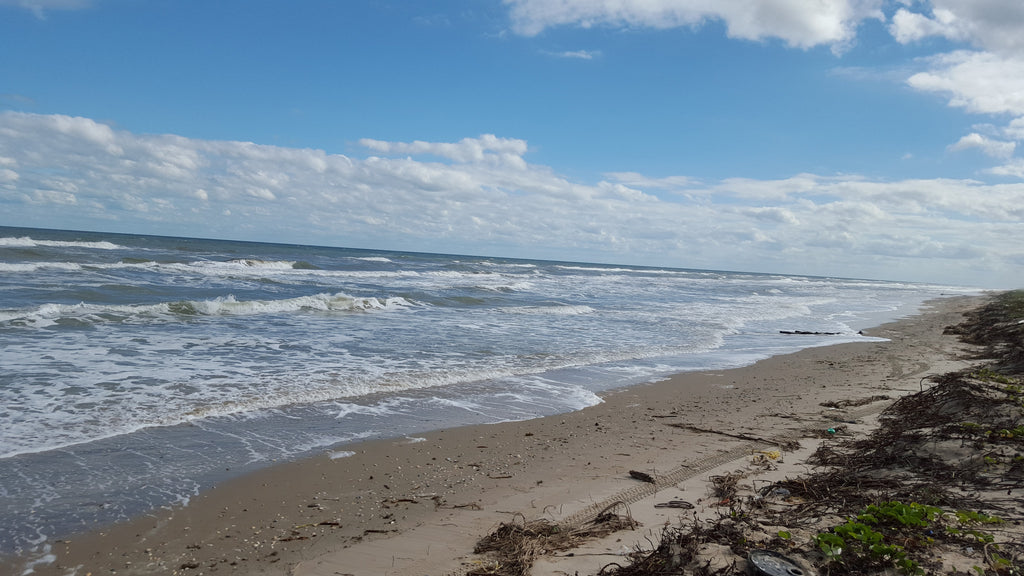
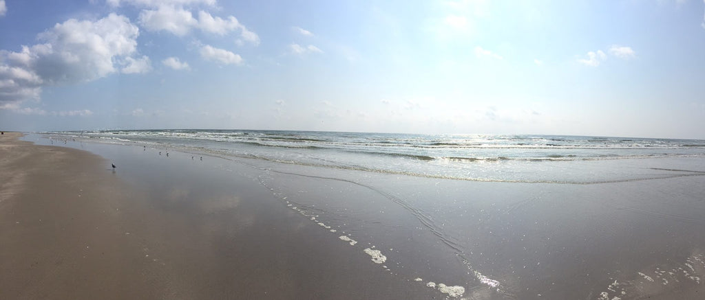
Sure hope it rains this coming week and packs that loose sand down some. The water was green all the way but really pretty the farther south we went. Quite a bit of Turtle Grass from the bay was scattered along stretches of the beach; especially on the north end but no sargassum weed was observed. No wildlife and very few fishermen were observed. The trash in the Big Shell area isn’t too bad this year due to the abundance of high tides which cover it up. There is more trash on the south ½ of the Big Shell. Lots of Valentine's balloons have already been washing in. Billyballon Sections should be able to knock out a mile easier than usual and if this is the case PLEASE hop scotch your way to the north and pick up more trash rather than quit. It sure would help how many miles we can clean. Weather forecast sounds good with temperatures ranging from the 50s to 70s but there is a 50% chance of rain. Of course the forecast could change. The tide forecast is for low tide levels. No migrating birds yet. Bird species observed included 1 White-tailed hawk, 1 Osprey, 1 Northern Harrier, good numbers of Ruddy Turnstones, Sanderlings, 1 Black-bellied plover, Brown Pelicans, Royal and Forester’s Terns, 1 Wimbrel, Laughing, Ring-billed and Herring gulls, 25 Long-billed Curlews and 66 Horned Larks. Hope to see you on the 27th! Billy

Read more


Cold Stunned Turtle Update 1/4- 1/5/2016

By Tyler Thorsen

Via Dr. Donna Shaver From 4-5 January 2016, 4 cold stunned green turtles were found in Texas. Temperatures have warmed, but colder weather is predicted for next week. The numbers of cold stunned sea turtles found to date during the 2015-2016 cold stunning season in Texas are as follows: All were green turtles. Area Total Galveston Area/ Inshore 1 Lavaca/San Antonio Bay 0 Copano Bay 0 San Jose Island 0 Mustang Island/Aransas Pass 2 Upper Laguna Madre/Corpus Christi Bay 1 Padre Island National Seashore Gulf Beach 0 Lower Laguna Madre 0 Boca Chica Beach 0 TOTAL 4 Condition Total Alive 4 Dead 0 TOTAL 4 Thank you to staff and volunteers from the National Park Service, ARK, Sea Turtle, Inc., Texas Parks and Wildlife Department, Sea World San Antonio, NOAA-Fisheries, Texas Sea Life Center, Texas Master Naturalists, Gladys Porter Zoo, University of Texas, Texas State Aquarium, other organizations, and private citizens for their help to find, document, rehabilitate, and release cold stunned turtles on the Texas coast this year. Data presented here are preliminary. Do not cite or quote without permission. Contact Donna Shaver, Texas Coordinator of the Sea Turtle Stranding and Salvage Network, for further information.

Read more


FoP Beach Report 11/23/2015

By Tyler Thorsen

FoP Beach Report 11/23/2015
Friends of Padre made a trip down PINS yesterday to check on current conditions. Driving was excellent at low tide, but tough at high tide as the water covered the beach in some areas restricting driving onto the high road. Very minimal sargassum observed on the beach. The surf was rough due to the strong northerly winds. Reports of redfish and jacks being caught. There is a large amount of wood debris on the beach including very large trees. These trees make driving difficult in some areas as many are located across the low and middle roads. No red tide aerosols were noted, although some foamy reddish water was observed along the second sand bar. This may have been the result of the wind-driven high surf rather than the presence of red tide. Three dead cownose rays were seen on the beach although no other dead fish were present. Mullet were present, although they were holding close to the bottom and were not easily seen. With winds expected to switch and build throughout the week, the surf will remain up. Birds observed: Great Blue Heron Crested Caracara Aplomado Falcon Sanderling Red Knot Piping Plover Semi-palmated Plover Black-bellied Plover Ruddy Turnstone Willet Long-billed Curlew Whimbrel Laughing Gull Ring-billed Gull Herring Gull Franklin's Gull Least Tern Caspian Tern Royal Tern Sandwich Tern Brown Pelican Cormorant 11_23_2015_1 11_23_2015_2 11_23_2015_3

Read more


Red Tide Status Update 10/23/2015 via TPWD

By Tyler Thorsen

Courtesy of Alex Nunez Red Tide Status Update Reporting Period: October 21 to October 23 @1200 Texas Parks and Wildlife Department is working with other agencies to monitor a red tide event along the southern Texas coast. The bloom was first confirmed on Sunday, September 13, by the University of Texas Marine Science Institute who collected samples around the fish pass jetties on Mustang Island due to strong aerosols. Water samples collected and analyzed for Karenia brevis densities are given the following designations:  Background = Less than < 1 cell/ml  Very Low = 1 to 10 cells/ml)  Low = 10 to 100 cells/ml  Moderate = 100 to 1,000 cells/ml  High = Greater than 1,000 cells/ml Regional Updates Upper Coast (Sabine Lake, Galveston Bay, East Matagorda Bay, Matagorda Bay): Water Samples Gulf of Mexico  Image Flow Cytobot at Texas A&M Galveston continues identifying K.brevis cells at background concentrations near Pelican Island (Galveston). Galveston Bay Area  No new updates during this reporting period. East Matagorda/Matagorda Bay area  TPWD staff at the Perry R. Bass observed nothing unusual at the research station. Baitfish present appeared to be healthy. Fish kills Gulf of Mexico  No new updates during this reporting period East Matagorda/Matagorda Bay  On 10/21/15, TDSHS observed dead menhaden near MSC marker 36. Mid Coast (San Antonio Bay, Aransas Bay, Corpus Christi Bay, Upper Laguna Madre) Water samples Gulf of Mexico  Over the past 24 hrs., the TAMU Image Flow Cytobot at the UTMSI Pier in Port Aransas has reported K.brevis cell maintaining low to very low concentrations. Water samples collected for K.brevis by PINS ranged between low and very low. Due to unseasonably high tides, staff was only able to get to the 15 mile marker. Sampling sites included the 7.5 miles from the 0 mile marker, 0 mile marker, and North Park Boundary. San Antonio Bay  No new updates during this reporting period Aransas Bay  Water samples collected for K.brevis by TDSHS in Aransas Bay indicated very low to low concentrations along the south eastern side of the bay from long reef south to Lydia Ann Channel. All other sites indicated background concentrations.  Water samples collected for K.brevis by TDSHS in Mesquite Bay indicated low to moderate concentrations. Corpus Christi Bay  Streaking continues to be observed along the southern section of Corpus Christi Bay along the Corpus Christi bay front. Discolored water was present along the Nueces Causeway as well  Water samples collected for K.brevis by TDSHS in Corpus Christi Bay indicated low to high concentrations. Highest concentrations were observed near the mouth of Oso Bay, in Corpus Christi Marina and in La Quinta Channel west of the turning Basin.  Water samples collected for K.brevis by Texas A&M – Corpus Christi, Center for Coastal Studies in Corpus Christi Bay indicated high concentrations along the southern shoreline at Cole and Ropes parks. Upper Laguna Madre  Water samples collected for K.brevis by PINS at Bird Island Basin included background concentrations. Fish kills Gulf of Mexico  No new updates during this reporting period San Antonio Bay  On 10/19/15, TPWD observed distressed menhaden in San Antonio Bay, just north of Mosquito Point between the ICWW and Seadrift. Aransas Bay  No new updates during this reporting period Corpus Christi Bay  While conducting routine monitoring sampling TPWD staff observed aerosols, predating gulls, and floating fish in the western and southern parts of the bay. Floating fish included menhaden, mullet, a couple large black drum and sheepshead, and a single Spanish mackerel. Stations in the eastern end of the bay were free of dead fish and aerosols.  While conducting K.brevis sampling, TDSHS observed dead fish halfway across bay from Shamrock Cove south to Oso Bay. More dead fish all the way from Oso Bay to La Quinta Channel following the shoreline. All species affected. Upper Laguna Madre  TPWD staff observed a fish kill along the southwest corner north of the JFK causeway. There was a mix of mullet, red drum, hardheads, and a flounder. The fish had probably been dead for a couple of days with a few more (<10) floating in with the east wind.  While conducting routine monitoring sampling TPWD staff observed no discolored water, aerosols, or dead fish in neither Night Hawk nor the adjacent portion of the Laguna Madre. Additionally, no discolored water, aerosols, or dead fish were observed from Bird Island Basin south. Rio Grande Valley (Lower Laguna Madre) Water Samples Gulf of Mexico  Water samples collected by the Red Tide Rangers along the beach of South Padre Island indicate low to high concentrations. Lower Laguna Madre  Water samples collected for K.brevis by the Red Tide Rangers around the Brazos Santiago Pass area indicate low to moderate concentrations.  Water samples collected for K.brevis by the Red Tide Rangers from the Queen Isabella Causeway north to the South Padre Island Convention Center area indicate background to moderate concentrations. Convention Center has increased to >200 cells/mL, the highest seen at this site. Fish Kill Gulf of Mexico  No new updates during this reporting period. Lower Laguna Madre  While conducting routine monitoring sampling, TPWD staff observed no dead fish nor water discoloration 3 miles north and 5 miles NE of the Arroyo Colorado. However, light aerosols were observed.  While conducting routine monitoring sampling, TPWD staff observed no fresh dead fish around the old causeway and Meziquita

Read more


Padre Island National Seashore Red Tide Update 10/2/2015

By Tyler Thorsen

Padre Island National Seashore Red Tide Update 10/2/2015
Via Padre Island National Seashore Good News and Happy Weekend! Yesterday's tests results came back and we are happy to say that it looks like the Red Tide has moved on (for the most part). The beaches around Malaquite campground, the visitor center and down to the 15 mile marker came back with Low Levels of the red tide algae! Around the 30 levels are a bit higher at the Moderate Levels. It isn't until around the 45 that the red tide levels reach High Levels and down near the channel the levels are higher still, about 5 times higher than around the 45MM. If you are coming out to the beach you still want to be careful of the remains of dead fish. While the high tides have moved most of them up to the dune line there still may be some in the high road portion of the driving beach. The spines and bones from fish can pop tires so please be aware and try to avoid these hazards. Enjoy your weekend and the beautiful beach weather! redtide redtide2

Read more


Red Tide Status Update Via Texas Parks and Wildlife 9/25/2015

By Tyler Thorsen

Courtesy of Alex Nunez Red Tide Status Update Reporting Period: September 23 to 25 @1000 Texas Parks and Wildlife Department is working with other agencies to monitor a red tide event along the southern Texas coast. The bloom was first confirmed on Sunday, September 13, by the University of Texas Marine Science Institute who collected samples around the fish pass jetties on Mustang Island due to strong aerosols. Water samples collected and analyzed for Karenia brevis densities are given the following designations:  Background = Less than < 1 cell/ml  Very Low = 1 to 10 cells/ml)  Low = 10 to 100 cells/ml  Moderate = 100 to 1,000 cells/ml  High = Greater than 1,000 cells/ml Regional Updates Upper Coast (Sabine Lake, Galveston Bay, East Matagorda Bay, Matagorda Bay):  Image Flow Cytobot at Texas A&M Galveston identified K.brevis cells at background near Pelican Island (Galveston).  Results from water samples collected by TDSHS in Galveston Bay area were 0 cells/mL. Mid Coast (San Antonio Bay, Aransas Bay, Corpus Christi Bay, Upper Laguna Madre) Water samples Gulf Of Mexico  Over the past 24 hrs., the TAMU Image Flow Cytobot at the UTMSI Pier in Port Aransas has reported K.brevis cell densities maintaining at low concentrations.  Water samples collected on Mustang Island are characterized as low.  Water samples from PINS are generally characterized as high densities with cell concentrations increased further south around the 20 mile marker. The northern boundary of PINS was characterized as moderate. San Antonio Bay  Data received yesterday from water samples collected by TDSHS on 9/21/15 identified a bloom around the Port O’Connor area. Cell densities ranged from high, near the mouth of the big jetties, to moderate near Port O’Connor. Aransas Bay  Water samples collected by TDSHS in Aransas and Copano bays came back as background with 0 cells/mL Corpus Christi Bay  Water samples collected by TDSHS in Corpus Christi Bay have ranged from Background to High, with the greatest concentrations observed in Redfish Bay, La Quinta Channel, and the western section of Corpus Christi Bay. Streaking was observed along the southern section of Corpus Christi Bay from TAMU-CC to Ropes Park. Upper Laguna Madre  Results of water samples collected by PINS at Bird Island Basin 0 cells/mL  A water sample collected near Pita Island was identified as High. Fish kills Gulf of Mexico  All planned fish kill assessments have been completed for the week San Antonio Bay  No New Updates Aransas Bay  No New Updates Corpus Christi Bay  No New Reports Upper Laguna Madre  All planned fish kill assessments have been completed Rio Grande Valley (Lower Laguna Madre) Water Samples Gulf of Mexico  Water samples collected along the beach of South Padre Island has maintained moderate to high concentrations, with highest observed at Beach Access Rd 6. Lower Laguna Madre  Water samples collected in the Lower Laguna Madre, near the Convention Center has maintained low cell concentration.  Water samples collected in Brazos Santiago Pass and the Lower Laguna Madre has maintained cell concentration at moderate concentrations. Fish Kill Gulf of Mexico  Fish kill assessments were conducted. Results pending.

Read more


Texas GLO Adopt a Beach Events for Some Gulf Beaches Closed This Saturday 9/26 due to Red Tide

By Tyler Thorsen

All of the Gulf Beaches from San Jose Island to South Padre Island including Padre Island National Seashore will not be doing the Adopt a Beach program this Saturday 9/26 due to the red tide. Areas such as Cole Park and others in Aransas Bay will go on as scheduled. http://www.glo.texas.gov/adopt-a-beach/cleanups/locations.html

Read more


Red Tide Update for Padre Island National Seashore 9/23/2015

By Tyler Thorsen

Corpus Christi, TX -Reported conditions for Red Tide (Karenia brevis), a known harmful algal bloom (HAB), for Texas through Thursday, September 24 confirms dead fish and respiratory irritation from the Port Aransas/Mustang Island to Padre Island National Seashore regions. Water samples have confirmed background (less than 1 cell/ml) to high (> 1,000 cells/ml) concentrations of Red Tide along the coast of Texas from Galveston Bay to the Rio Grande (TPWD; 9/17-9/23). Samples collected along Padre Island have documented an increase in cell concentrations ranging from moderate to high, with the greatest densities observed at the Padre Island National Seashore from Mile marker 0 to mile marker 19. Winds forecasted today through Thursday have the potential to promote high levels of respiratory irritation in from Aransas Bay to the Rio Grande. Concentrations are patchy and discomfort to the eyes, nose, and throat will vary based upon local bloom concentrations, ocean currents, and wind speed and direction. Children, elderly, and individuals with asthma commonly experience elevated sensitivity and should avoid areas causing symptoms. Common symptoms include: coughing, sneezing, tearing, skin irritation, and difficulty breathing among others. Dogs are particularly sensitive to these conditions and may become sick or even require advance veterinary care if they ingest dead fish or lick any part of their body that comes into contact with beach sand or Gulf water.
redtideIf you plan on coming to the seashore please come prepared for the conditions. Bones and spines of dead fish can puncture feet and lead to serious infections. Driving conditions are also difficult; the number of fish on the beach makes this hazard hard to avoid and may leave you stranded with punctured vehicle tires. Caution is advised for persons with respiratory problems, infants, and pets being on the beach at this time. If you start to cough, have a burning sensation in your throat or itchy eye it is recommended that you leave the beach area.

For additional information: http://tidesandcurrents.noaa.gov/hab/ http://tidesandcurrents.noaa.gov/hab/beach_conditions.html https://tpwd.texas.gov/landwater/water/environconcerns/hab/redtide/status.phtml https://tpwd.texas.gov/landwater/water/environconcerns/hab/redtide/faq.phtml

Read more